- No posts where found
Related Articles
Archaeologist aren’t anything like the movies paint them out to be. Most of the time they sit around sift dirt in hopes of discovering something exciting. Given a little time archaeologist can stumble upon some rather interesting artifacts that defy the very nature of logic and convention….
1. The Giant Rock Monument Under the Sea of Galilee….
A team of Israeli archaeologist, in 2003, were performing a seabed survey on the Sea of Galilee. While digging they uncovered an artifact that shocks many of them, to this day…..

This image may look like a smudge, but to the trained eye, its much more! Up close, this giant rock under the Sea of Galilee, is composed of thousands of meticulously arranged stones. It is cone shaped and measures 230 feet in diameter and stands 39 feet high, weighing 60,000 tons. Making this mysterious stone twice as large as Stonehenge and 6 times heavier than the Eiffel Tower.
Scientist at this time are unable to speculate just how old this object is, claiming it can be anywhere from 3,000-6,000 years old. One thing they agree on however, is that the stone was more than likely built on land and flooded later. If you are a Bible believer, such as myself, that means that this stone was built pre-flood of Noah. Meaning this was more than likely built by the giant race of Nephilim spoken of in the book of Genesis.
At this time the purpose of the stone is unknown, but some believe it was either an artificial fish nursery, a ancient European burial site, or a Reverse Atlantis.
2. Thousands of Circular Wheel Patters

Back in 1927, RAF pilot Percy Maitland stumbled upon these unique wheel like stone patters while on a routine mail delivery flight. These patterns were up to 230 feet in diameter and there were thousands of them across the landscape. They are easily seen on Google Maps and can be found from Syria to Jordan to Saudi Arabia and some are grouped in clusters, while others are more isolated. There is no suspected rhyme or reason to their laying.
No one, at this time, seems to know why they there or how they got there. Archaeologists have studied thousands of these images over the years and found no convincing explanation for anything. Although some man-made structures can be found near these circles, there is still no definitive answer. Some speculate they could be associated with burial rituals or possible alien launchpads, but then again this is just speculation.
Tribesmen, who live in the area however, claim that they are the workings of “old men” or “ancient men”. It is likely then that the creators of these mystifying circles are the Nephilim Giant race found in the Bible. They are the ‘ancient men’ of times past, and the only ones capable of creating things on such a grand scale.
3. Teotihuacan, the Real Temple of Doom

Outside of Mexico City exists a place known as Teotihuacan. It is a vast city of pyramids and palaces. It could house up to 250,000 persons and was a bustling metropolis. Teotihuacan was discovered by the Aztecs but not built by the them. They discovered it hundreds of years after its creation when the original inhabitants had abandoned it.

Susana Gonzalez/Getty Images News/Getty Images
The question their in lies who lived there, who created it, and how on earth did they build such a gargantuan city?
According to Aztec folklore, this amazing city was built by the ‘gods’. Teotihuacan, the name given to the city by the Aztecs literally means “place of the gods”. At this time no other theory exists, no writings, no discoveries can explain this monolithic structure whose origins seem to be shrouded in mystery. However, Biblically speaking, there is an answer. If this so called city was created by the ‘gods’ it’s also likely that such massive rocks and carvings were the workings of the Nephilim race of giants, yet again. These beings were claimed to be ‘gods’ by many of our ancient ancestors. Although, biblically speaking they are pure evil, because of their size and birth by fallen angels and humans, many hailed them as such.
One other thing that points to the Nephilim giants as one of its inhabitants, is the fact that hundreds of human skeletons were discovered sacrificed inside one of the pyramids, ringing an eerie likeness to the Book of Enoch that speaks of these Nephilim giants as cannibals.

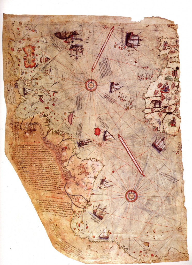
4. Piri Reis Map of The World Pre-Continental Split

In the beginning God created the world as one big land mass. However today, we’ve got continents scattered all over the place because of things like Noah’s flood, earthquakes, volcanoes, and shifts in the earth’s crust.
A map discovered in the early 1500′s displays exactly what the world looked like, pre- Noah’s flood. This map is known as the Piri Reis Map and according to it, was compiled from earlier maps dating back to the 300′s.
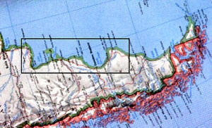
Charles H. Hapgood, who wrote a book about the maps mysteries titled, “Maps of the Ancient Sea Kings”, discovered a partial charting of Antarctica made during a period when the coast was free of ice. This coastal structure, now covered again by ice, was subsequently verified by satellite radar scanning.
Here is an image of Antarctica turned sideways:

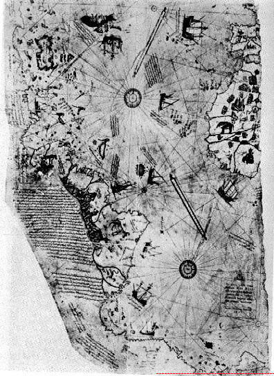
Here is the Piri Reis map showing the area that coincides geographically with Antarctica, it’s underlined in red (look to the lower right):

The Piri Reis map shows amazing details including accurate latitude placement of many well known islands along the southern most coastlines of Antarctica, which would be near impossible for people to create who were living in that time period. They just weren’t technologically advanced enough….or were they?
What Hapgood actually proved was that the Piri Reis map was plotted out in plane geometry, containing latitudes and longitudes and right angles in a traditional “grid” fashion. Meaning that this so-called un-advanced generation, was advanced more than we realized or had some sort of outside help from a Nephilim race of UFO’s. There was definitely something else going on!
One shocking find on this map is the fact that it not only claimed the earth was round, but it was also able to pinpoint the circumference within 50 miles! The accuracy of it is beyond any capabilities of men living at that time unless they had some sort of aerial transportation. It is no coincidence, however, that this map covers between Peru to Egypt:
In Egypt there are hieroglyphs of every type of aerial machine, and multiple plane designs.

In Peru there are many plane designs and hot air balloons captured in miniature images. There is also evidence that the Peruvians used hot air balloons along with geoglyphs and what appear to be landing strips on top of mountains.
It is possible that this ancient civilization was aided by Nephilim technology? If so the Piri Reis map would explain it.
If not how else do you explain an accurate aerial map of all of the continents, during a period when most of the scientific world believed the earth to be flat?
5. Antikythera Mechanism

This Mechanism is considered the world’s fist analogue computer. It was discovered when sponge divers, in Antikythera, dove in off the coast in 1900AD and found this in ocean.
This archeological find dates back to the 2nd century BC, making it well over 2,000 years old and it is a complex system of gears, dials and cogs with amazing precision. Scientist agree that it represents something that would not be seen again until the rise of clocks thousands of years later.
Many speculate that it was used as an astronomy calculator that predicted and measured the cycle of planets in relation to the Sun, Earth, and Moon.
This mechanism has been x-rayed, studies, and attempts have been made to reconstruct it, however its very existence still seems to baffle the minds of scientists today.
What is coincidental is the fact that off the coast of Crete there is a unique historical record of ancient robots of “immense size”. Furthermore there is a story in Crete of a robot named Talos, who hurled boulders at ships. If we take this into consideration it’s likely that this story represents the Nephilim Giant race and therefore likely that the Nephilim equipped the humans with the technology to create such an artifact.
The video below contains some other unique artifacts you might find interesting…
For More information See:
http://greaterancestors.com/greater-technology/
http://www.bibliotecapleyades.net/mapas_pirireis/esp_mapaspirireis04.htm


